Gorilla Trekking Permit Prices in 2026 Gorilla trekking is a once-in-a-lifetime experience that draws travelers…
Satellite Tracking of Mountain Gorilla Movements
Satellite Tracking of Mountain Gorilla Movements: How Scientists Monitor Gorilla Ranging Patterns
Mountain gorillas are among the most closely monitored great apes in the world. Their survival depends on continuous conservation efforts, habitat protection, scientific research, and responsible tourism. One topic that often sparks curiosity among wildlife enthusiasts is satellite tracking of mountain gorilla movements. Many people wonder how researchers follow gorillas through dense forests, monitor their ranging behavior, and gather data that helps protect these endangered primates.
The reality is more complex than simply attaching a GPS collar to a gorilla. Due to ethical concerns and conservation guidelines, mountain gorillas are generally not fitted with tracking collars. Instead, scientists use a combination of satellite technology, GPS mapping, field observations, remote sensing, and advanced data analysis to understand how gorilla groups move across their habitat.
Understanding these movement patterns provides valuable insights into gorilla behavior, habitat use, family dynamics, food availability, and conservation planning. It also helps authorities manage tourism activities in Uganda, Rwanda, and the Democratic Republic of Congo while ensuring minimal disturbance to gorilla populations.
Understanding Mountain Gorilla Movements
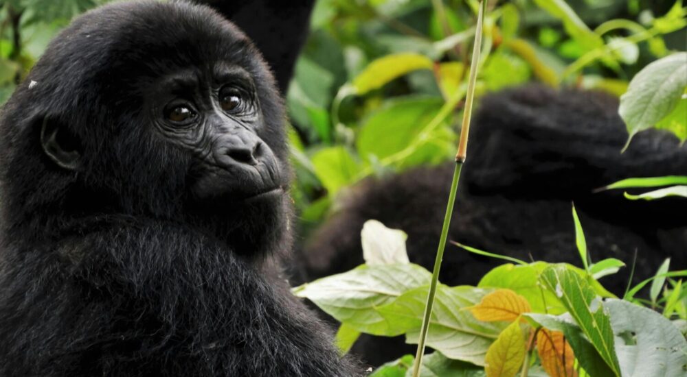
Mountain gorillas inhabit the montane forests of the Virunga Massif and Bwindi Impenetrable National Park. These forests contain varying elevations, vegetation types, and food resources that influence gorilla movement.
Unlike migratory animals that travel vast distances, mountain gorillas typically maintain relatively stable home ranges. However, their daily movements can vary significantly depending on food availability, weather conditions, social interactions, and habitat characteristics.
A gorilla family may travel anywhere from several hundred meters to several kilometers in a single day. Their movements often involve feeding, resting, socializing, and nesting activities. Researchers monitor these movements to better understand how gorillas interact with their environment.
The study of mountain gorilla movements has become increasingly important as conservationists seek to protect habitats that are under pressure from human population growth, agriculture, and climate change.
Why Tracking Gorilla Movements Matters
Tracking gorilla movements serves several critical conservation purposes.
Scientists use movement data to identify important feeding areas, breeding zones, nesting sites, and migration corridors within gorilla habitats. These findings help park authorities make informed management decisions.
Movement monitoring also helps conservation teams detect changes in gorilla behavior that may signal habitat degradation, disease outbreaks, or increased human disturbance.
By understanding where gorillas spend most of their time, conservation organizations can focus anti-poaching patrols and habitat protection efforts in key locations.
Additionally, tourism authorities use movement information to manage gorilla trekking experiences responsibly. Accurate location data helps trackers find habituated gorilla families while minimizing stress on the animals.
The information gathered through movement studies contributes directly to the long-term survival of one of Africa’s most iconic wildlife species.
The Role of Satellite Technology in Gorilla Conservation
When discussing satellite tracking of mountain gorilla movements, it is important to understand that satellites are usually not tracking individual gorillas directly.
Instead, satellites provide essential environmental information that supports gorilla research.
High-resolution satellite imagery allows scientists to monitor forest cover, vegetation health, habitat changes, and human encroachment around protected areas.
Researchers can compare satellite images taken over several years to identify changes in forest structure and habitat quality. These observations help conservationists understand how environmental factors influence gorilla movement patterns.
Satellite technology also helps map:
- Forest boundaries
- Habitat fragmentation
- Water sources
- Vegetation zones
- Human settlements
- Agricultural expansion
This information is combined with field observations to create detailed models of gorilla ranging behavior.
GPS Mapping and Gorilla Monitoring
One of the most important tools used in modern gorilla conservation is GPS technology.
Field researchers and trackers accompany habituated gorilla groups and record precise GPS coordinates throughout the day. These coordinates are later analyzed to create detailed movement maps.
GPS mapping helps researchers determine:
- Daily travel distances
- Home range sizes
- Seasonal movement patterns
- Habitat preferences
- Interactions between neighboring gorilla groups
Over time, thousands of GPS points create a comprehensive picture of how gorilla families use their environment.
These movement maps are often integrated with satellite imagery, producing highly accurate representations of gorilla ranging patterns across the landscape.
This approach provides many of the benefits associated with satellite tracking while avoiding the need to place tracking devices directly on gorillas.
Why Mountain Gorillas Are Not Usually Fitted with Satellite Collars
Many wildlife species are monitored using GPS collars that transmit location data to satellites. However, mountain gorillas present unique challenges.
Conservation authorities prioritize the welfare of gorillas above all else. Capturing and collaring gorillas would require anesthesia and physical handling, which carry risks for both animals and researchers.
Several factors make collaring unsuitable:
Ethical Considerations
Mountain gorillas are critically important conservation species. Any procedure that could potentially harm them receives intense scrutiny.
Researchers strive to minimize human interference whenever possible.
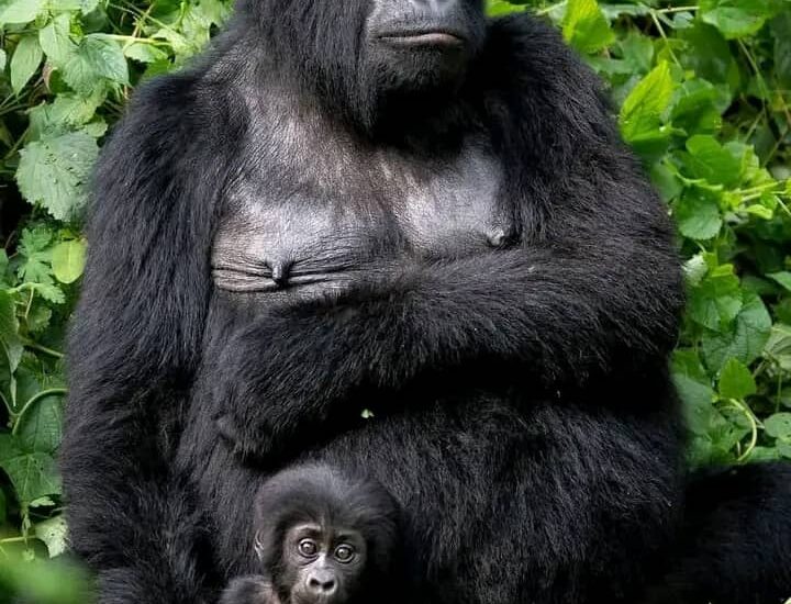
Social Behavior
Gorillas live in close-knit family groups. Collars may interfere with social interactions or attract unwanted attention from group members.
Dense Forest Environment
The thick vegetation of mountain forests can reduce satellite signal effectiveness and complicate collar performance.
Effective Alternative Methods
Since habituated gorilla groups can be followed directly by trained trackers, researchers already have highly effective ways to monitor movement without invasive technologies.
As a result, conservation programs rely primarily on non-invasive tracking techniques.
Daily Tracking by Gorilla Researchers
A significant portion of gorilla movement monitoring occurs through direct observation.
Each day, trained trackers enter the forest and locate known gorilla groups. Once found, researchers document numerous aspects of gorilla behavior and movement.
Data collected may include:
- GPS location points
- Feeding behavior
- Nesting locations
- Group composition
- Travel routes
- Interactions with neighboring groups
This information forms the foundation of long-term gorilla movement studies.
Because some gorilla families have been monitored continuously for decades, scientists possess remarkably detailed records of their ranging behavior.
These datasets provide valuable insights that would be difficult to obtain through technology alone.
Remote Sensing and Habitat Analysis
Remote sensing is another important component of mountain gorilla tracking.
Remote sensing refers to collecting environmental data from satellites, drones, and aerial imagery without direct contact with the ground.
Researchers use remote sensing to study:
Vegetation Distribution
Different plant species provide varying food resources for gorillas. Mapping vegetation helps explain movement decisions.
Forest Health
Healthy forests support larger and more stable gorilla populations.
Climate Impacts
Temperature and rainfall patterns influence food availability and habitat suitability.
Human Activities
Remote sensing helps identify illegal activities such as encroachment, logging, and unauthorized agriculture.
Combining remote sensing data with field observations creates a comprehensive understanding of gorilla habitat use.
How Scientists Analyze Gorilla Home Ranges
A home range represents the area regularly used by a gorilla group.
Scientists calculate home ranges by plotting thousands of GPS locations collected over months or years.
These analyses reveal:
- Frequently visited areas
- Core feeding zones
- Seasonal shifts
- Territorial overlap
- Resource distribution
Home range studies have shown that gorilla groups often share portions of their habitat while maintaining distinct social territories.
Understanding these spatial relationships helps conservationists manage protected areas more effectively.
Seasonal Influences on Gorilla Movements
Although mountain gorillas do not migrate over long distances, seasonal changes can affect their movement patterns.
Food availability is one of the primary drivers.
During periods when preferred food sources become scarce, gorilla groups may travel farther to locate sufficient nutrition.
Rainfall patterns also influence movement. Certain vegetation types flourish during wetter periods, attracting gorilla groups to specific areas.
By analyzing movement data alongside environmental conditions, researchers gain deeper insights into gorilla ecology.
This information becomes increasingly valuable as climate change alters habitats across East and Central Africa.
Technology and Anti-Poaching Efforts
Movement monitoring plays a significant role in anti-poaching operations.
Conservation authorities use tracking information to identify areas frequently used by gorillas and prioritize patrol activities.
When trackers notice unusual movement patterns, rapid investigations can be launched.
Satellite imagery helps detect:
- New trails
- Illegal settlements
- Forest clearing
- Encroachment activities
Combining these technologies improves protection for gorillas and other wildlife species.
Many conservation successes in Uganda’s Bwindi Impenetrable National Park and Rwanda’s Volcanoes National Park have been supported by advanced monitoring systems.
Gorilla Tourism and Movement Monitoring
Gorilla trekking depends heavily on accurate knowledge of gorilla locations.
Every morning, trackers locate habituated gorilla families before tourists enter the forest.
Movement monitoring allows park authorities to:
- Manage visitor numbers
- Reduce search times
- Protect gorilla welfare
- Minimize habitat disturbance
- Enhance visitor experiences
This careful balance between conservation and tourism has contributed significantly to the recovery of mountain gorilla populations.
Revenue generated from gorilla trekking supports local communities and conservation initiatives across the region.
Visitors who participate in ethical gorilla trekking directly contribute to the ongoing protection of these remarkable primates.
Future Innovations in Gorilla Tracking
Emerging technologies may further improve our understanding of mountain gorilla movements.
Researchers continue exploring innovative approaches such as:
Artificial Intelligence
AI systems can analyze large datasets and identify movement trends that might otherwise go unnoticed.
Drone-Based Monitoring
Specialized drones may assist with habitat mapping and environmental assessments.
Advanced Satellite Imaging
Higher-resolution imagery continues to improve habitat monitoring capabilities.
Predictive Conservation Models
Scientists increasingly use movement data to predict how gorillas may respond to environmental changes.
These technologies are expected to strengthen conservation planning while maintaining the non-invasive principles that guide gorilla research.
What Gorilla Movement Research Reveals About Conservation Success
One of the most encouraging outcomes of movement studies is the evidence they provide regarding conservation success.
Long-term monitoring has shown that many gorilla groups are thriving within protected habitats.
Researchers have documented:
- Population growth
- Stable family groups
- Expanded habitat use
- Successful reproduction
- Increased protection effectiveness
Mountain gorillas remain one of the few great ape species whose population numbers have increased in recent decades.
This achievement reflects decades of collaboration among governments, conservation organizations, researchers, local communities, and responsible tourism operators.
The continued study of mountain gorilla movements will remain essential for sustaining this progress.
Experience Gorilla Conservation Firsthand
The science behind gorilla movement monitoring becomes even more meaningful when experienced in person.
A gorilla trekking safari allows visitors to witness firsthand how trackers locate gorilla families deep within their forest habitat. You gain a greater appreciation for the expertise involved in conservation and the remarkable efforts required to protect these endangered primates.
At Monumental Expeditions and Safaris, we organize unforgettable gorilla trekking experiences in Uganda and Rwanda, connecting travelers with one of Africa’s greatest wildlife encounters while supporting sustainable tourism practices.
Plan Your Gorilla Safari Today
Discover the world of mountain gorillas, learn about their behavior, and witness conservation in action through expertly guided gorilla trekking adventures.
Visit Monumental Expeditions and safaris to explore customized gorilla safari packages, trekking permits, wildlife tours, and East African travel experiences.
Speak with Our Safari Experts
Whether you are planning a dedicated gorilla trekking holiday or a broader East African wildlife safari, our experienced team can help create an itinerary tailored to your interests, travel dates, and budget.
Explore the incredible forests of Uganda and Rwanda and see how science, conservation, and tourism work together to protect mountain gorillas for future generations.
Related Posts
Eco-Friendly Gorilla Trekking: Conservation & Community Benefits Explore the importance of eco-friendly gorilla trekking and…
How to See Gorillas in Congo Are you eager to see gorillas in Congo and…