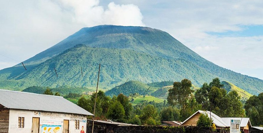
Mount Elgon National Park: A Majestic Gem of East Africa Introduction Mount Elgon National Park,…
Hiking Trails on Rwenzori Mountains
Rwenzori Mountains National Park – Trekking in the Mountains of the Moon
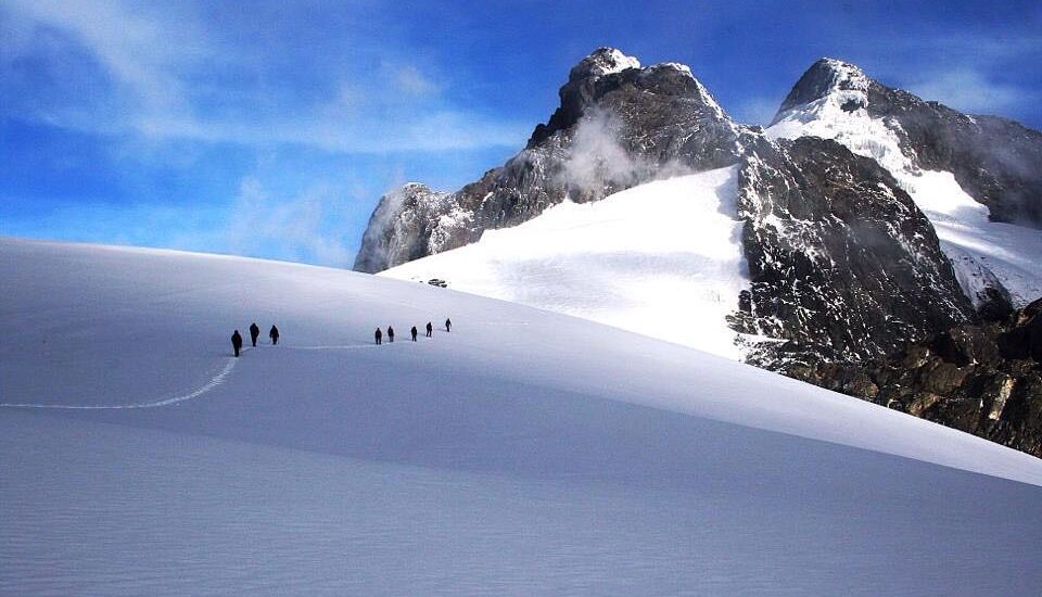
The Rwenzori Mountains National Park is one of Africa’s most scenic and unique trekking destinations. It takes visitors through six distinct vegetation zones. These include the tropical forest zone (680–1,800 meters), Afromontane forest (1,800–2,600 meters), bamboo forest (2,600–2,900 meters), heather zone (2,900–4,000 meters), Afro-alpine moorland (4,000–4,500 meters), and the rocky/glacier zone (4,500–5,109 meters).
The park spans approximately 100,000 hectares in southwestern Uganda and includes much of the Rwenzori mountain range, which is home to Africa’s third-highest peak—Margherita Peak at 5,109 meters. Recognized as a UNESCO World Heritage Site, the Rwenzori Mountains are known for their diverse plant life, ranging from lush tropical rainforests to bamboo forests, montane cloud forests, and alpine flora.
Hiking Trails in the Rwenzori Mountains
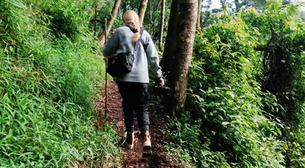
The Rwenzori Mountains attract trekkers from around the world, offering a chance to explore a rich diversity of flora and landscapes. For those without advanced mountaineering experience, there are two main trekking routes that offer rewarding experiences without requiring expert skills.
Central Circuit Trail
The Central Circuit is the oldest and most popular route to reach Margherita Peak. Managed by the local Bakonjo community, this trail is considered less strenuous and more accessible to beginner hikers. It offers spectacular views of the surrounding peaks like Baker, Speke, and Stanley, as well as opportunities to observe diverse flora, birdlife, and some mammals. The circuit also allows hikers to explore various parts of the mountain through multiple connecting paths. Accommodation on this route is available in basic wooden huts located at designated stops.
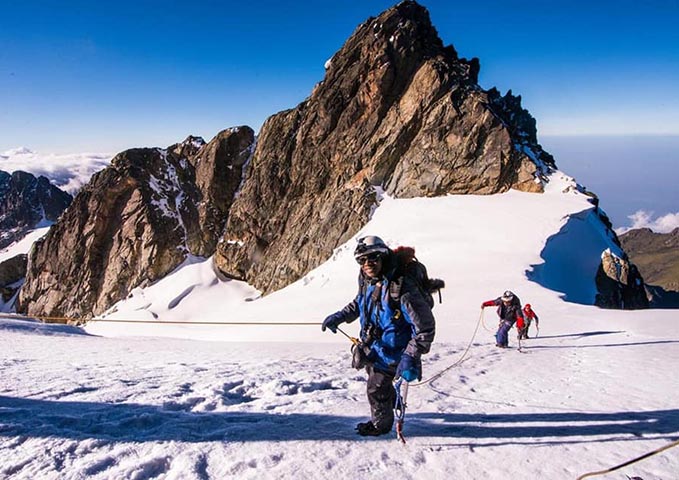
Kilembe Trail
The Kilembe Trail is more challenging than the Central Circuit and is recommended for experienced hikers. It features steep and demanding sections but rewards trekkers with exceptional beauty and fewer crowds. This route also passes through varied landscapes including forests, moorlands, and alpine zones. Like the Central Circuit, accommodation is provided in mountain huts along the trail.
Best Time to Visit the Rwenzori Mountains
The Rwenzori Mountains can be visited year-round. However, the best time for trekking is during the dry seasons, from July to October and December to February. These months offer better weather conditions, making the climb more comfortable and safer. Many travelers combine Rwenzori treks with gorilla or chimpanzee trekking during this time.
Wet Seasons:
-
Long rainy season: March to May
-
Short rainy season: November
While rain is possible any time of year, it tends to be heavier and more frequent during these months, making trails slippery and climbing more strenuous.
High vs. Low Season Trekking
High Season (July–September, December–February):
This is the most popular time to trek due to drier weather and clearer views. Trails may be busier, but the experience is more comfortable overall.
Low Season (April, May, November):
During the low season, trails are quieter, and you may enjoy more solitude. Rain typically falls in the afternoons, and most trekking is done in the morning, which can minimize the impact of weather. Some tour operators, including Monumental Expeditions and Safaris, offer discounted rates during this period.
Wildlife and Birdlife in the Rwenzori Mountains
The Rwenzori Mountains are home to 70 mammal species and 177 bird species. While large animals like elephants, chimpanzees, Rwenzori otters, and leopards live here, they are rarely seen due to the dense forest. However, primates such as Angola and black-and-white colobus monkeys, blue monkeys, and small antelopes like bushbucks are more visible.
The region is also a designated Important Birding Area (IBA) due to its rich birdlife. Notable species include:
-
Rwenzori Turaco
-
Handsome Francolin
-
Barred Long-tailed Cuckoo
-
Long-eared Owl
-
Cinnamon-chested Bee-eater
-
Archers’ Robin-chat
-
Golden-winged Sunbird
-
Strange Weaver
…and many more.
Frequently Asked Questions About Hiking the Rwenzori Mountains
What type of mountain is Rwenzori?
The Rwenzori Mountains are a rugged mountain range formed by tectonic forces along the western rift valley. They consist of ancient rocks uplifted from the surrounding plains.
Is there internet on Mount Rwenzori?
There is currently no internet access on the mountain. Internet is available at the base.
What accommodation is available?
Accommodation during treks consists of practical mountain huts built to withstand harsh weather. In the foothills, you’ll find comfortable lodges, hostels, and campsites.
Is it difficult to hike Mount Rwenzori?
Yes, the Rwenzori Mountains are among the most challenging treks in Africa, with varied terrain including forests, lakes, cliffs, glaciers, and snow-capped peaks.
Do I need a guide?
Yes, professional guides are required. Monumental Expeditions and Safaris provides experienced Rwenzori guides familiar with all major trails.
Is altitude sickness a concern?
Altitude sickness can be a concern at higher elevations. Consult a doctor before your trip and carry prescribed medication if needed.
Why are the Rwenzori Mountains called the Mountains of the Moon?
Ancient Greek explorers believed these mountains to be the source of the Nile. Around AD 150, Ptolemy referred to them as the “Mountains of the Moon” due to their snow-capped appearance.
Why are the peaks snow-capped?
The high elevation results in lower temperatures and increased moisture, leading to frequent snowfall. However, global warming is causing glaciers to melt over time.
How long does a trek take?
-
Low altitude treks: 2–4 days (below 4,000 meters)
-
High altitude treks: 4–12 days (above 4,000 meters)
How much luggage should I carry?
You’ll need:
-
A small backpack for daily use
-
A duffel bag (max 15 kg or 33 lbs) for porters to carry
What is the highest peak in the Rwenzoris?
Margherita Peak on Mount Stanley is the highest at 5,109 meters. It is Africa’s third-highest peak.
How do I get to the Rwenzori Mountains?
By road: The drive from Kampala via Fort Portal to Kasese takes 6–8 hours. A 4×4 vehicle is recommended.
By air: Daily flights are available from Entebbe to Kasese, lasting about one hour. Flights depart Entebbe at 7:00 AM and 12:30 PM and return from Kasese at 10:45 AM and 2:45 PM.
Related Posts